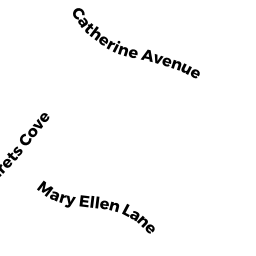
17 MARYELLEN LN
Owner Information
POWERS JOHN D
17 MARYELLEN LN
FRANKLIN, MA 02038


Property Details
17 MARYELLEN LN is classified as a Single Family Residential (Colonial).
The primary structure on this property was built in 1993. There are 2,943ft2 of built area within this property. There is 2,943ft2 of residential/living space within this property. This property is listed as having 9 rooms.
17 MARYELLEN LN is valued at $527,100. The land is valued at $255,600 and the structures are valued at $263,800. There is an additional valuation of $7,700 on this property.
The most recent deed for 17 MARYELLEN LN is recorded at the local registrar in Book 10373, Page 540. 17 MARYELLEN LN was last sold on Thursday, February 3, 1994 for $201,525.
Assessment data from fiscal year 2022.
Flood Data
According to the FEMA National Flood Hazard Layer, this property does not appear to be in a flood zone. It may also be in an area not yet reviewed. Nonetheless, confirm this information prior to taking any action.
To view the flood hazards around this property, create a FEMA "Firmette" Map of the area around 17 MARYELLEN LN.
Broadband Internet Providers
| Provider | Type | Bandwidth (mbps) | |
|---|---|---|---|
| GCI Communication Corp. | Satellite | 0 | 0 |
| Verizon New England Inc. | Fiber | 940 | 880 |
| Comcast | Cable | 1000 | 35 |
| VSAT Systems, LLC. | Satellite | 2 | 1 |
| HughesNet | Satellite | 25 | 3 |
| Viasat Inc | Satellite | 100 | 3 |
Broadband service provider data from December 2020.
Adjacent Properties
- 19 MARYELLEN LN
Single Family Residential owned by RANIERI SHALA TR L/E - 4 MARGARETS CV
Single Family Residential owned by KEANE JAMES F JR - 20 CATHERINE AVE
Single Family Residential owned by DOHERTY DANIEL F III - 15 MARYELLEN LN
Single Family Residential owned by BOYD ROBERT J - 18 CATHERINE AVE
Single Family Residential owned by MCGOVERN RICHARD S